DEC to mark trails on 12 formerly trailless Catskill peaks
Published on:
November 18, 2026




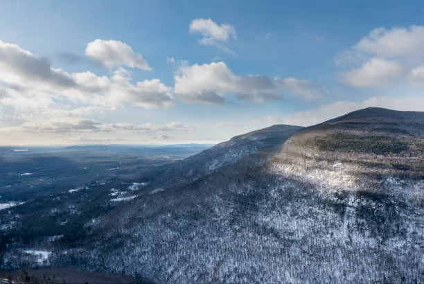





GREENE COUNTY—For generations, reaching the summits of some of the Catskills' most remote mountains meant hiking through forests without marked trails, using only a map, compass and a sense of adventure to find the way.
But as hiking has grown in popularity, many of those once-trailless mountains have become crisscrossed with unofficial paths, worn into the landscape by thousands of visitors following similar routes to the summits.
Now, after seven years of environmental assessments, visitor surveys and public input, the New York State Department of Environmental Conservation (DEC) has concluded that the mountains can no longer be considered truly trailless.
The agency this week released its final Formerly Trailless Catskill High Peaks Visitor Use Management Plan, calling for officially marked hiking routes on 12 of the 16 mountains included in the study.
The changes would affect several popular hiking destinations in Greene County, including Halcott Mountain, Rusk Mountain, Kaaterskill High Peak, North Dome and Mount Sherrill.
At the heart of the decision is a growing environmental problem: Since beginning its assessments in 2019, DEC researchers have documented more than 78 miles of informal, visitor-created trails on mountains historically managed without them.
Those routes have contributed to soil erosion, damaged vegetation and forest fragmentation, threatening sensitive high-elevation ecosystems that can take decades to recover from disturbances.
“After extensive community input and data collection, DEC finalized a strategic plan that balances public access with our long-term conservation goals in the Catskill Forest Preserve,” DEC Commissioner Amanda Lefton said. “The Formerly Trailless Catskill High Peaks Visitor Use Management Plan enhances natural resource protection while offering visitors excellent opportunities to enjoy the Catskill High Peaks safely, sustainably, and responsibly.”
Rather than eliminating hiking on the affected mountains, DEC intends to concentrate visitors along designated routes, allowing unnecessary informal paths to recover naturally.
Four mountains—Eagle, Southwest Hunter, Bearpen and Vly—do not currently require marked routes, although DEC will continue monitoring conditions on all 16 peaks.
The agency has not established a timetable for implementing the changes.
A growing number of hikers
The transformation of the Catskills' trailless peaks has been decades in the making, but DEC's findings suggest the pace of change has accelerated considerably.
According to summit registration records maintained with assistance from the Catskill 3500 Club, hikers recorded 171,511 sign-ins at mountain summit canisters between 2003 and 2025.
More than half occurred during the six years from 2020 through 2025, reflecting a dramatic increase in hiking activity that began during the COVID-19 pandemic.
The figures represent only hikers who signed the notebooks kept in small canisters near the summits, meaning actual visitation is likely considerably higher.
Hiking challenges have contributed to that popularity. In a 2023 survey, more than half of respondents reported participating in a Catskill hiking challenge, most commonly the Catskill 3500 Club challenge, which encourages hikers to climb the region’s highest mountains.
Technology has also changed the experience. Smartphone applications such as AllTrails and Strava have made routes to previously difficult-to-find summits more accessible.
But those applications do not always distinguish between official trails and unofficial routes. As hikers follow the same digital tracks, informal paths become increasingly established, sometimes branching into multiple routes through the surrounding forest.
Greene County mountains show signs of damage
The environmental consequences are particularly evident on several Greene County peaks.
On Halcott Mountain, DEC researchers documented an approximately 66-foot-wide area of trampled vegetation near the summit canister, where repeated foot traffic has exposed soil, rocks and tree roots.
Researchers also identified multiple informal routes leading to the summit, fragmenting sections of forest that otherwise would remain largely undisturbed.
Rusk Mountain presents similar concerns, with an extensive network of unofficial paths around its summit and along routes toward East Rusk Mountain. Repeated trampling has damaged vegetation in the mountain’s sensitive spruce-fir forest.
At Kaaterskill High Peak, one of the region’s best-known hiking destinations, DEC documented numerous informal routes, including paths leading to Hurricane Ledge, a popular viewpoint.
The agency proposes designating a preferred route to the summit and Hurricane Ledge, potentially eliminating much of the unofficial trail network at higher elevations.
North Dome and Mount Sherrill, in the Hunter-West Kill Wilderness, have also experienced substantial impacts. Researchers found that informal trails have divided portions of the surrounding forest into dozens of separate patches.
Although conditions vary by mountain, the proposed solution is largely the same: establish preferred routes, discourage unnecessary paths and give damaged areas an opportunity to recover.
Ancient forests and vulnerable birds
Beyond the visible trail damage, the report offers a glimpse into the ecological importance of the Catskills’ high-elevation forests, some of which have remained largely undisturbed by human activity for centuries.
Citing research by Catskill forest historian Dr. Michael Kudish, DEC notes that at least 110 square miles of first-growth forest remain in the Catskills.
Many of these forests escaped the logging, bark harvesting and fires that transformed much of the region’s lower-elevation landscape.
Interestingly, that does not necessarily mean the trees themselves are ancient. Individual trees in high-elevation spruce-fir forests rarely survive beyond 100 years because of harsh weather and extreme conditions.
These environments provide important habitat for specialized wildlife, including the Bicknell's thrush, a vulnerable migratory songbird that breeds in high-elevation forests.
Research conducted in 2023 suggested that the number of hikers using an area may have a greater influence on bird populations than whether a trail is officially designated.
Bird abundance and diversity were lowest along official trails and highest in areas with little or no human activity.
That presents a challenge for DEC. Marked trails could attract additional hikers, but concentrating visitors along designated corridors could also preserve larger areas of undisturbed habitat.
The report identifies late April through early July as a particularly sensitive nesting period for mountain birds.
What hikers think about the changes
Although marking trails would fundamentally change the experience of climbing some of the Catskills’ most remote mountains, DEC’s public surveys suggest considerable support for the approach.
In a 2023 survey, 71% of respondents supported designating formal trails along existing informal routes, while 83% favored additional educational signs explaining the importance of protecting vulnerable species.
Hikers were more divided over restrictions such as seasonal closures or permit systems, neither of which is proposed in the final plan.
For experienced hikers, navigating an unmarked mountain has long represented a different kind of challenge from following an established trail. Finding a route through the forest and locating a summit canister are central parts of that experience.
Officially marking routes could make some summits easier to navigate and potentially attract visitors who previously avoided them.
DEC acknowledges that possibility but maintains that the extensive networks of informal trails have already changed the character of these mountains.
What happens next?
DEC intends to prioritize locations where environmental damage is most severe, generally beginning by marking existing, heavily used routes rather than constructing entirely new trails.
Some sections may eventually be relocated or redesigned to reduce erosion and protect sensitive habitats. Unnecessary paths will be targeted for closure and rehabilitation.
The agency also plans to work with hiking application companies to update digital maps as routes change and will continue monitoring environmental conditions to determine whether the new approach is working.
For Greene County, the plan represents a significant change in how some of the Catskills' most remote mountains will be managed.
The changes will not happen overnight, and DEC has not established a timetable for completing all of the improvements. But the final plan establishes a new direction for managing mountains where hikers have traditionally been responsible for finding their own way to the summit.